
Room 300 in Kennebunk Town Hall was filled to capacity for Monday night’s meeting on the Kennebunk & Kennebunkport Active Transportation Plan, during which residents alternated nods of agreement on the existing lack of safety and connections for bicycles and pedestrians with complaints about lack of enforcement for parking and speeding infractions in both towns.
The meeting was the first of three public meetings for this plan, which, according to Tom Errico, study manager for consultant T.Y Lin, aims to create a plan for a safe, connected and accessible network for walking, biking and other non-motorized forms of travel. Hearing from attendees regarding their concerns on this topic was the main goal for the meeting, but Errico also gave an overview of what to expect from the study over the nine months it will take to be completed.
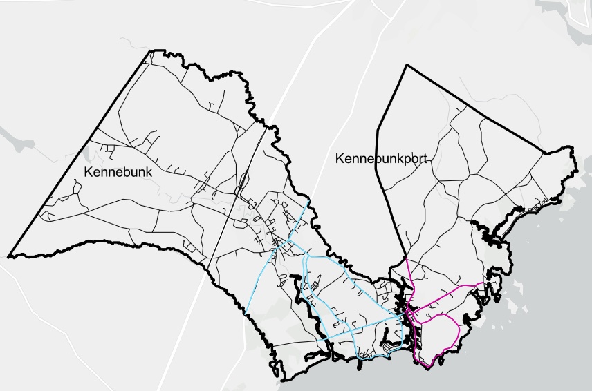
One point of discussion early on was the boundaries of the area to be included in the study. Several attendees indicated that areas outside the study area are also dangerous and wanted them included, specifically Route 99 in Kennebunk and Beachwood Avenue in Kennebunkport. Errico agreed that both were unsafe but indicated that a study covering both towns in their entirety was not possible based on the amount of funding available. He said that “initially the study was focused just on Dock Square and Lower Village, but it was expanded due to funding.”
Much of the work will be to identify weaknesses and opportunities in the existing transportation network for pedestrians and bicycles. Mapping missing or inconsistent sidewalks is a first step, and attendees chimed in with multiple examples, from School Street in Kennebunkport to South Main Street in Kennebunk.
The inconsistency of shoulders on Route 9 in Kennebunkport between Consolidated School and Cape Porpoise is another transportation gap. “We try to encourage kids to ride bikes but there is a shoulder on the east side of the road and not the west,” said Helena Brook, Kennebunkport.
Another attendee added “There are not a lot of bike programs for youth and you see them riding on the wrong side of road – the police should be involved in this.”
Creating safer ways to get across the street by adding new or improving crossing facilities is another focus of the study. And again, from Main Street to South Main and Lower Village in Kennebunk to Beachwood Avenue in Kennebunkport, there was no shortage of examples from the audience.
Errico presented data on local high vehicle crash locations – there is only one, in Kennebunk, from Dane Street to Nasons Court on Main Street – and also what MaineDOT calls “Elevated Crash Potential” locations. These higher risk locations are all intersections and include Kennebunk’s Main Street/Water Street, Route 1/Hannaford Plaza, Route 1/Ross Road, Western Ave/Sea Road and Western Ave/Chase Hill Road. Only one intersection in Kennebunkport qualifies, at Maine Street and South Main Street.
These locations are dangerous for everyone, but the bicycle and pedestrian crash data shows clusters of pedestrian crashes from 2016-2026 in Lower Village and Main Street in Kennebunk. Bicycle crash clusters from the same period are centered on, again, Main Street in Kennebunk, Route 1 North, Western Ave between Lower Village and Sea Road, and Dock Square in Kennebunkport.
Other information included vehicle traffic counts and speed limit maps. The highest number of vehicles is 14,641 at Route 1 at the Mousam River, based on average daily volumes measured over one year by MaineDOT. Attendees offered numerous anecdotes on speeding, not limited to out-of-state drivers.

A clear goal of the plan will be to make it safer, easier and more enjoyable to get around town without a vehicle. Errico explained that it is possible to “estimate the level of stress a bicyclist might have on a certain road,” based on the road’s traffic level, speed, volume and width. Bicycle heatmaps, derived from biking app data, track where many bicyclists are already traveling. Looking at these, it is possible to begin to map routes that avoid busy main streets but still connect people to key destinations. “We sign it and do traffic calming, so instead of coming up Main Street, people can slide through the neighborhoods,” said Errico.

A final thread of commentary from attendees was the challenges that illegal parking cause for walkers and bikers. Sarah Liziewski, Kennebunk, said that a boat on a trailer was illegally parked in the road by her house for weeks, blocking access. She believes the police should be more involved with managing illegal parking. Others noted illegal parking by Mothers Beach that puts bikes on the sidewalk, making the area unsafe for walkers. A third comment pointed to was cars stopping in crosswalks and blocking pedestrians trying to cross side streets, referred to as a common occurrence in downtown Kennebunk.
Errico said that this ongoing feedback from the public is needed, and asked attendees to go to the plan website to view the PowerPoint, get updated study information, and find dates for upcoming meetings.

")


